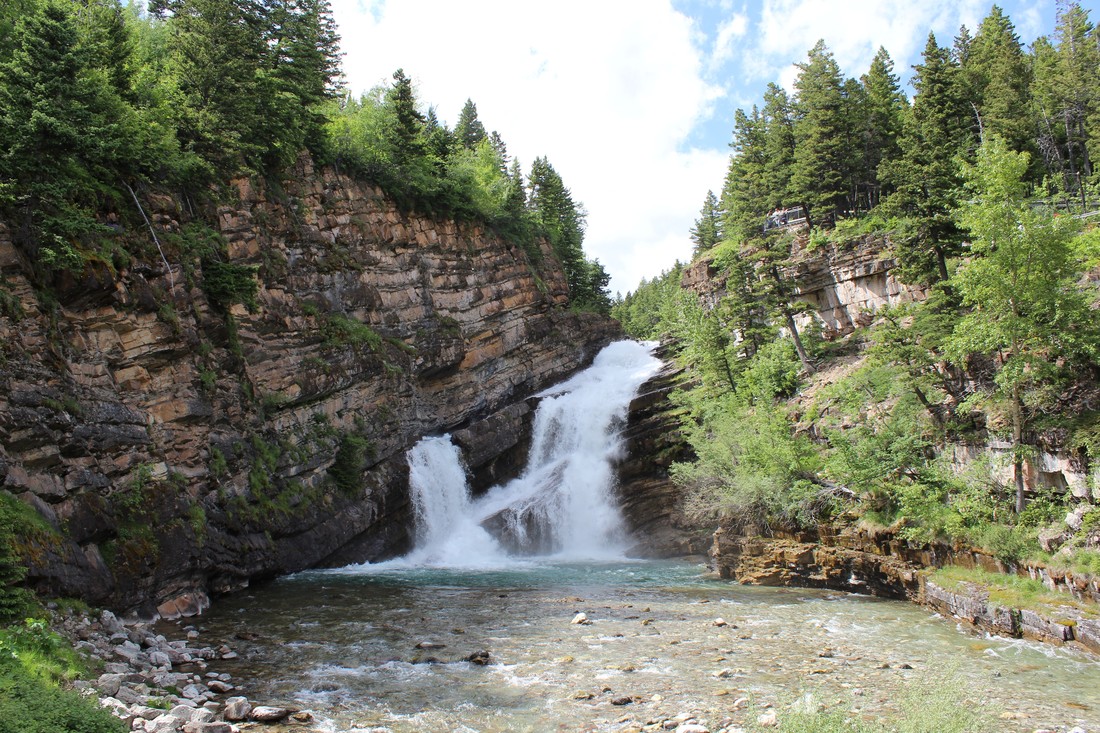
 Located right in the town of Waterton, this waterfall is hard to miss. Follow Evergreen Ave until you cross a small bridge over Cameron River. The falls will be on the right side. You can park your car up ahead on the left side of the road. This iconic spot is busy in summer months. You can find a trail on the right side of the falls that leads to some great viewpoints. (Or if you’re feeling like making a longer trek, you can follow the 19 km trail to Cameron Lake).
0 Comments
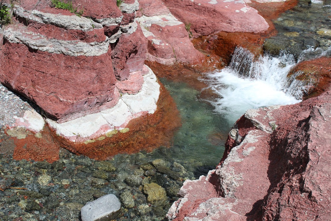
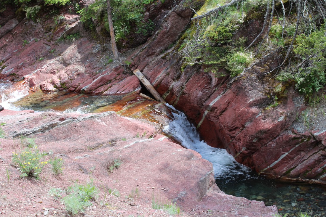
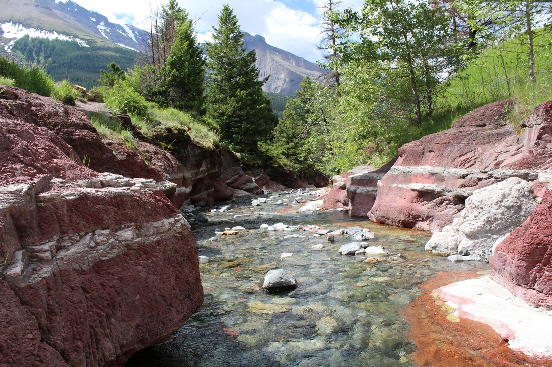
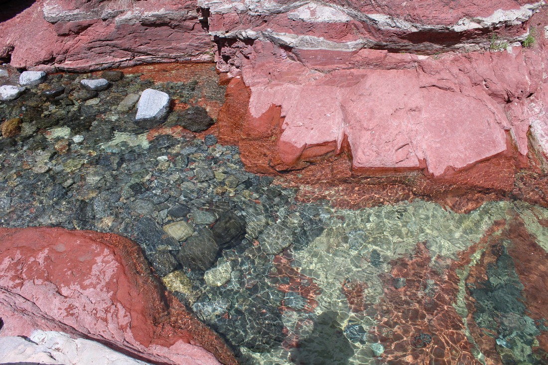
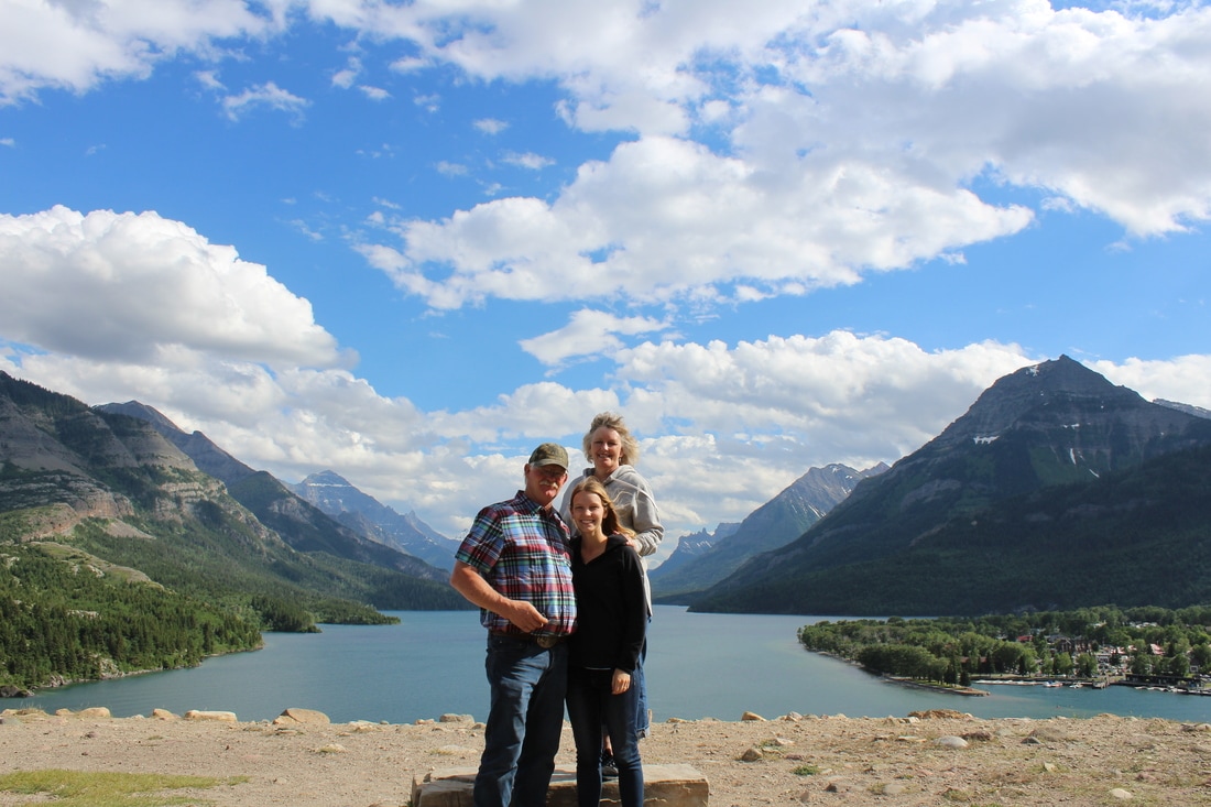
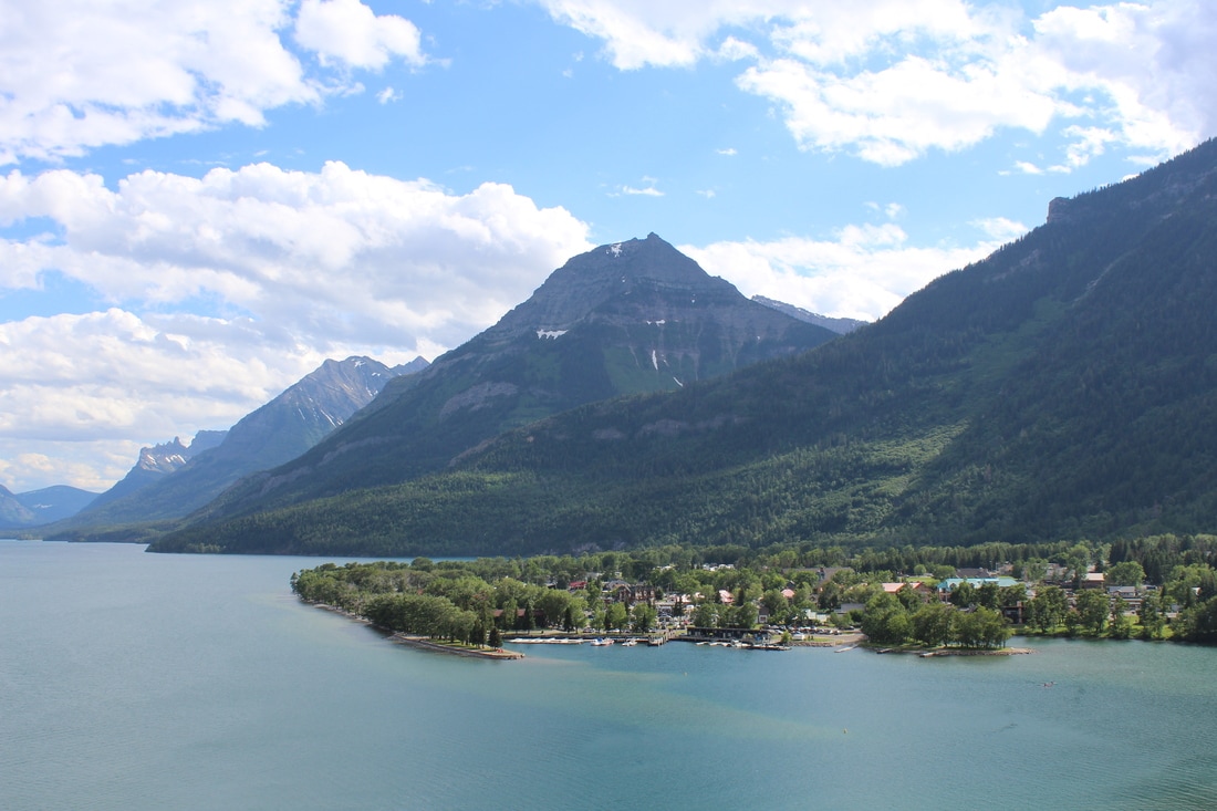
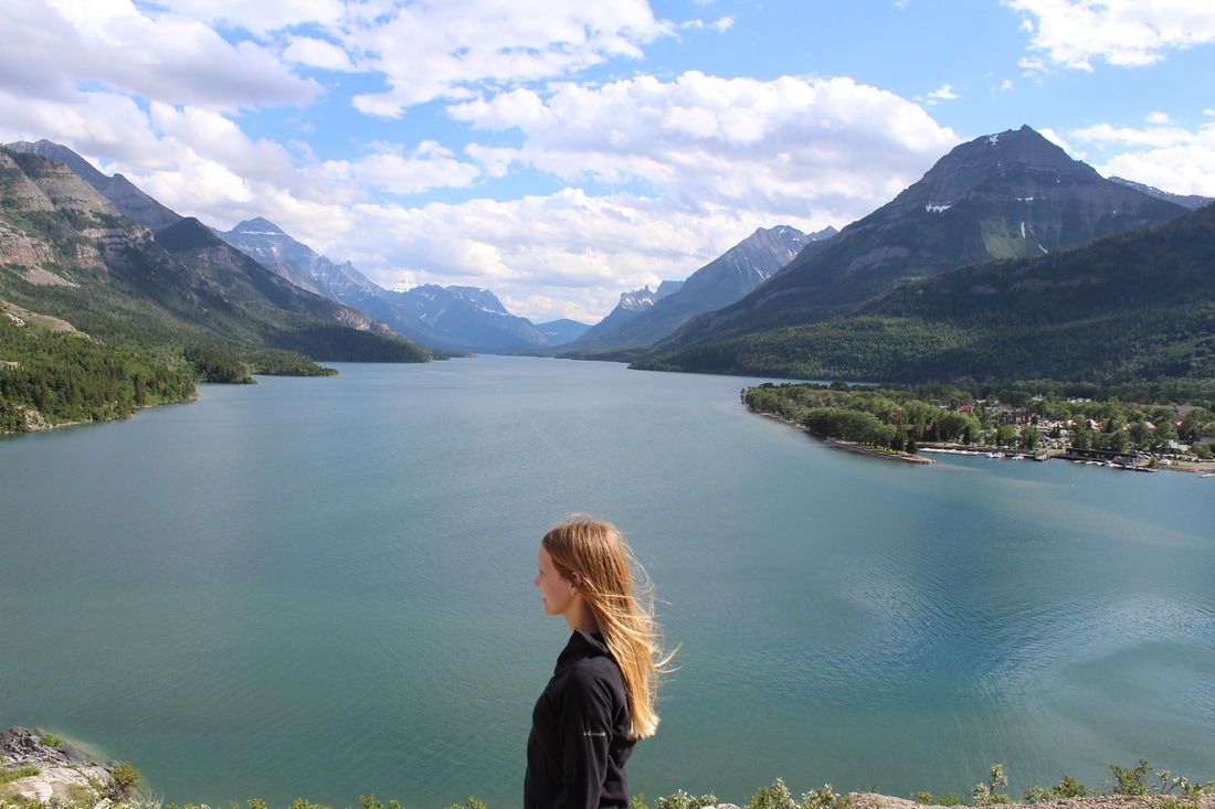
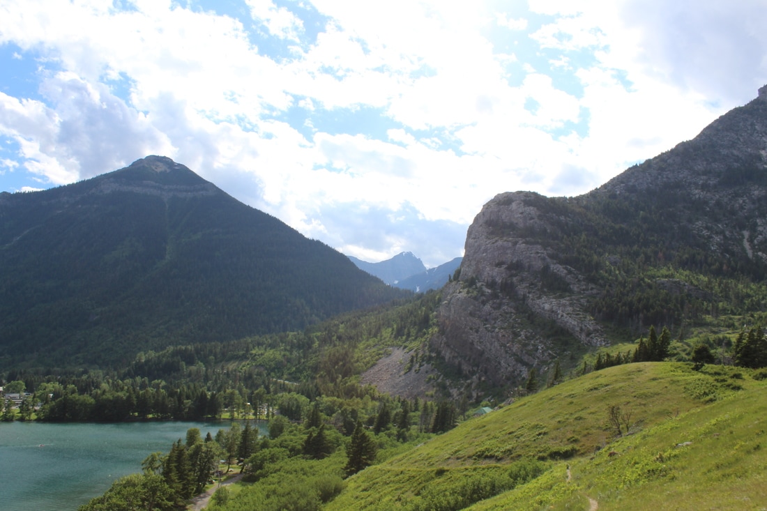
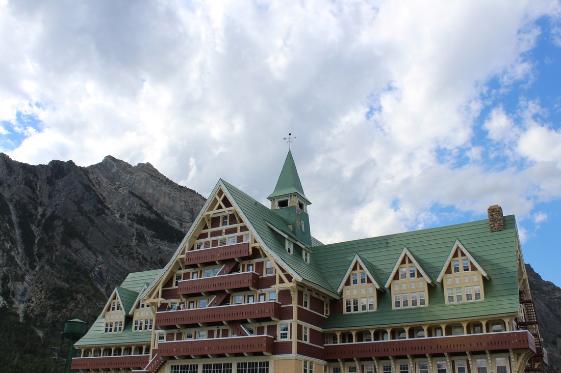
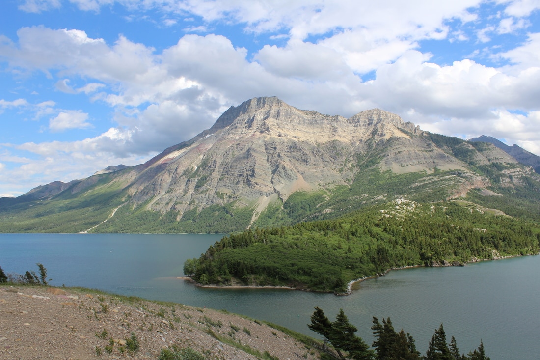
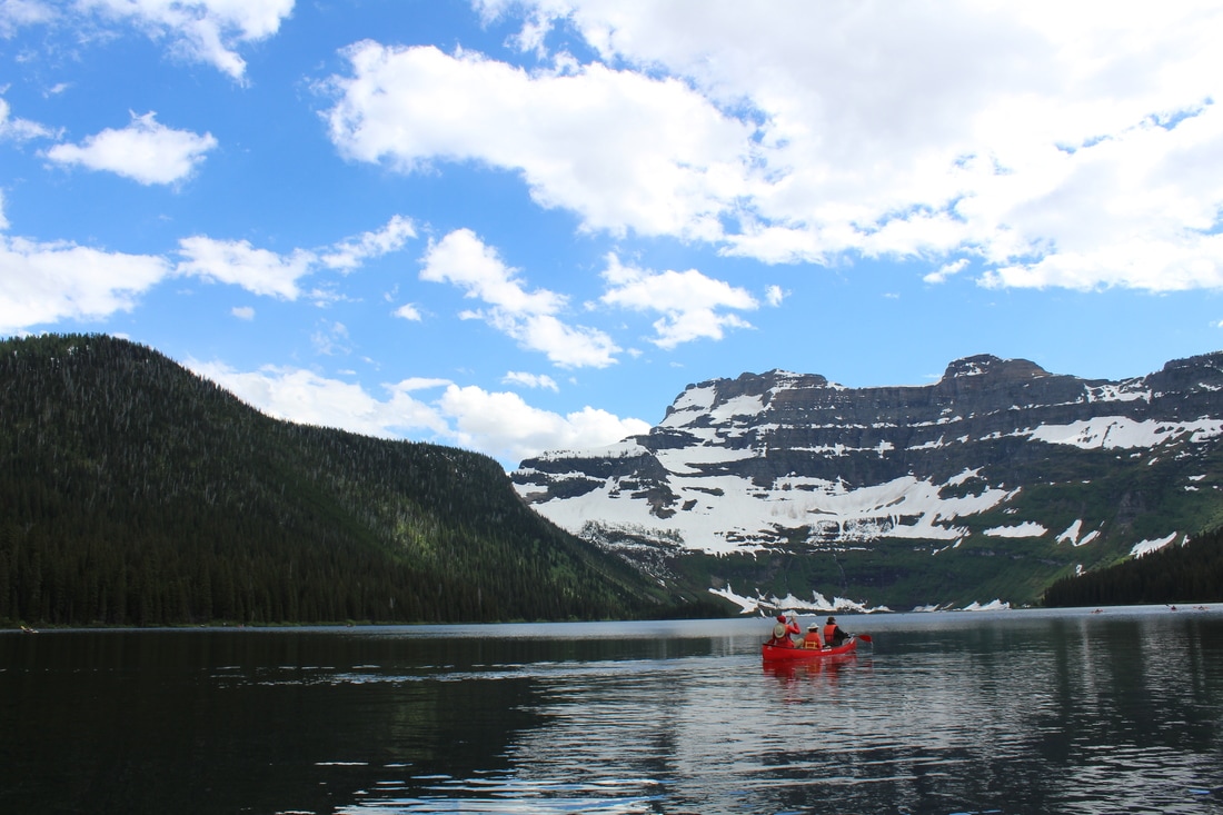
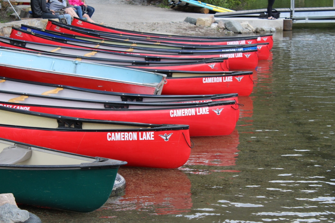
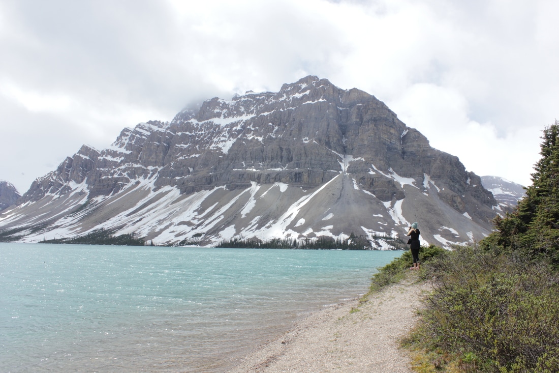
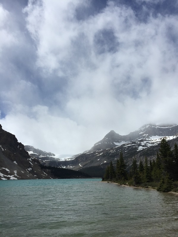
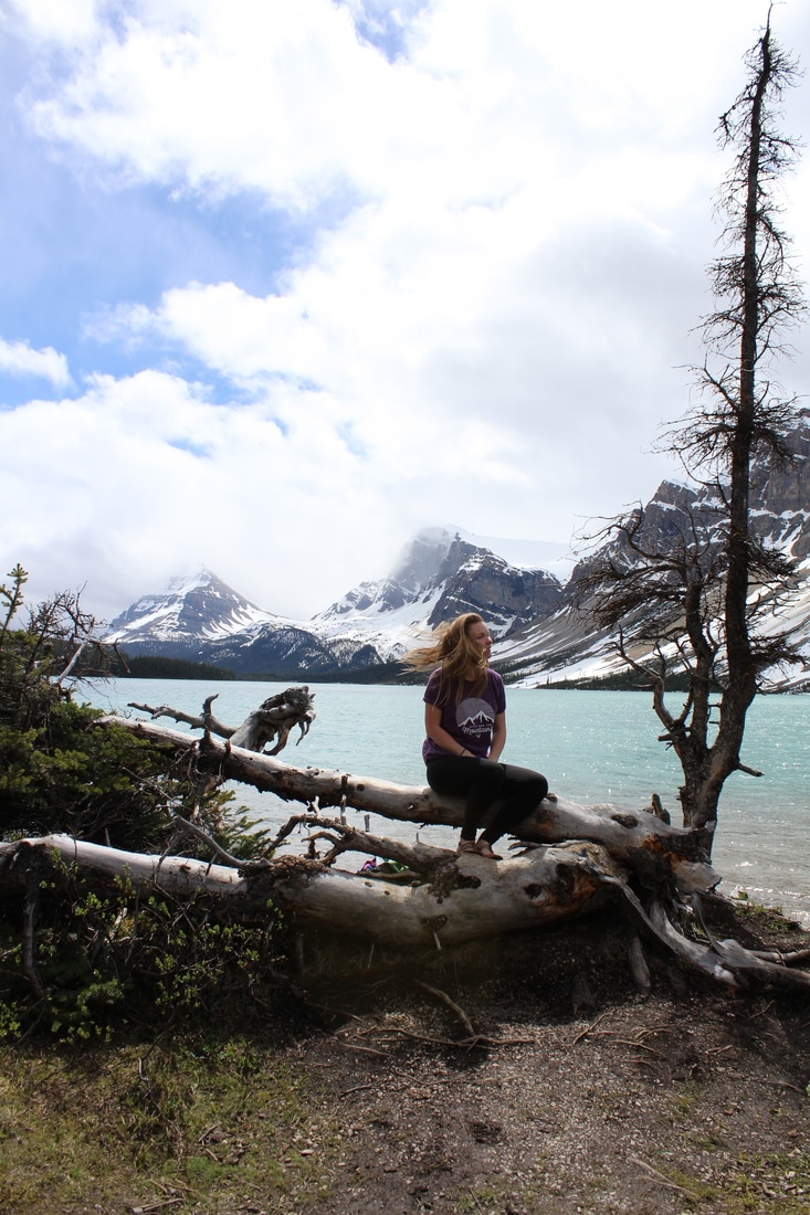
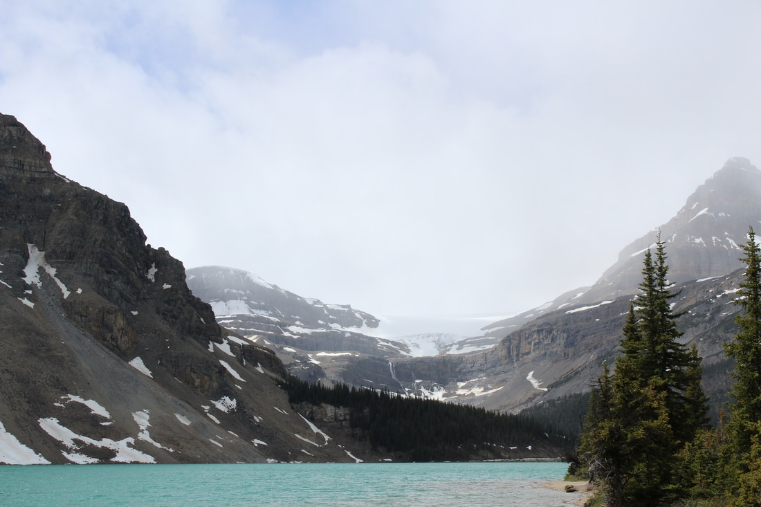
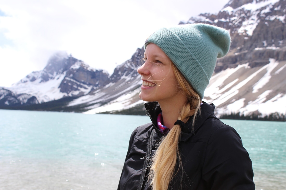
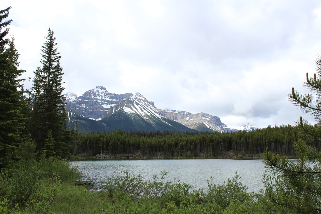
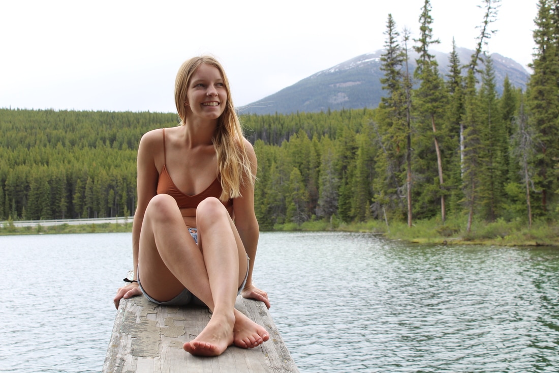
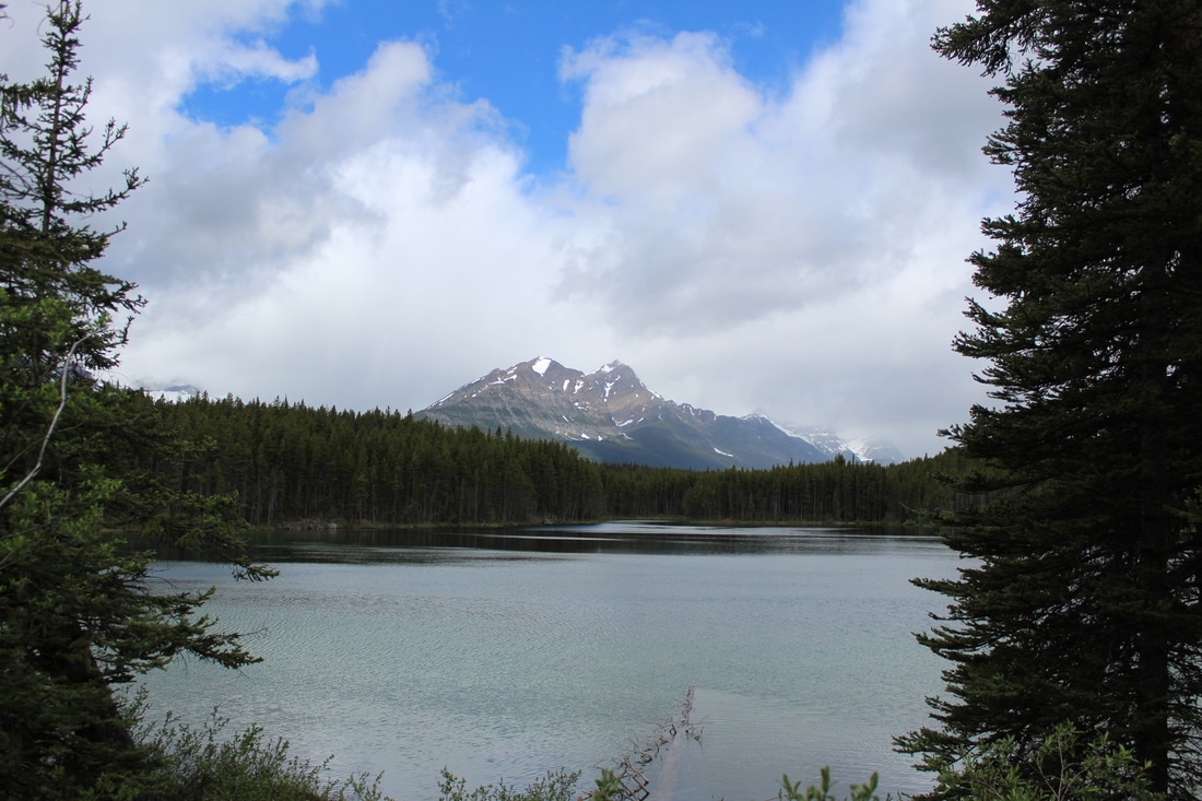
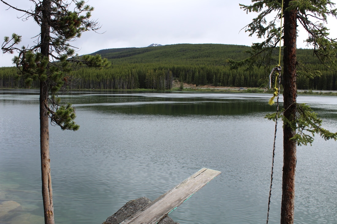
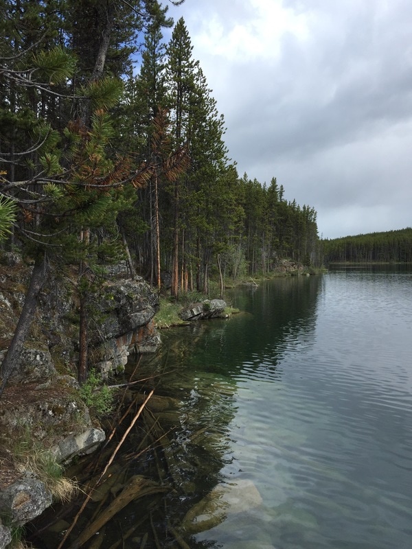
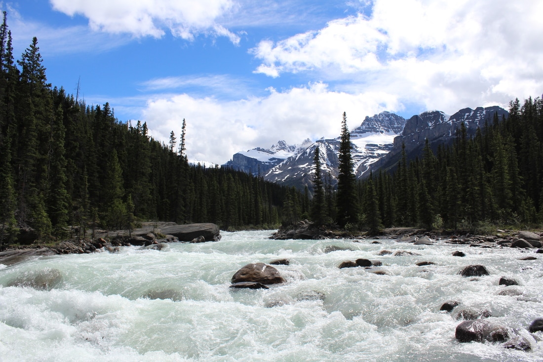
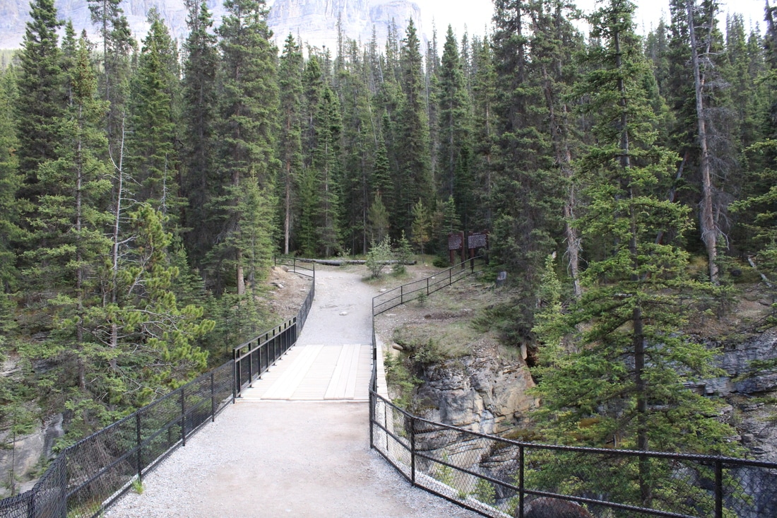
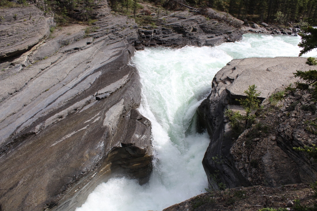
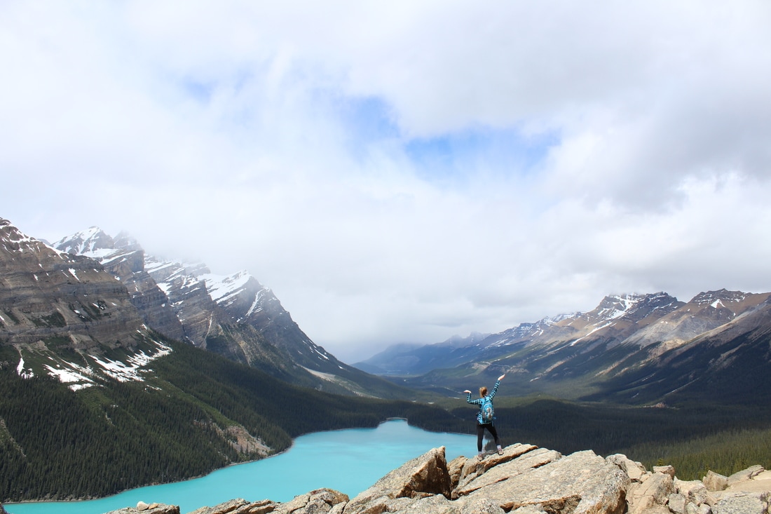
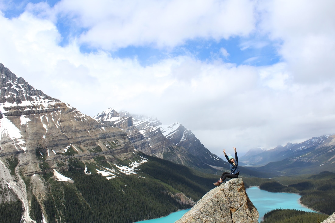
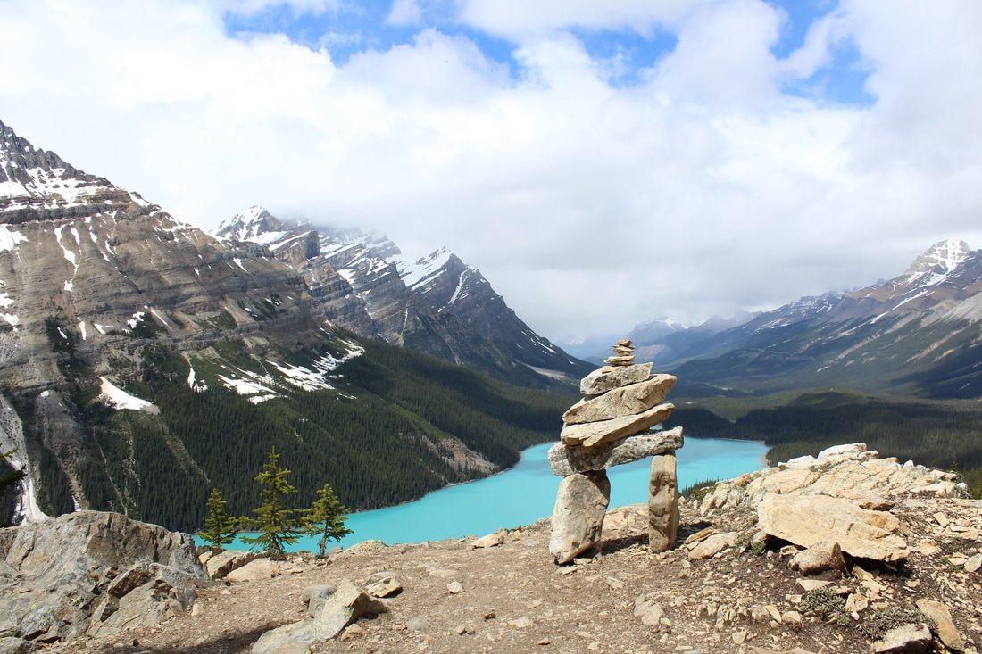
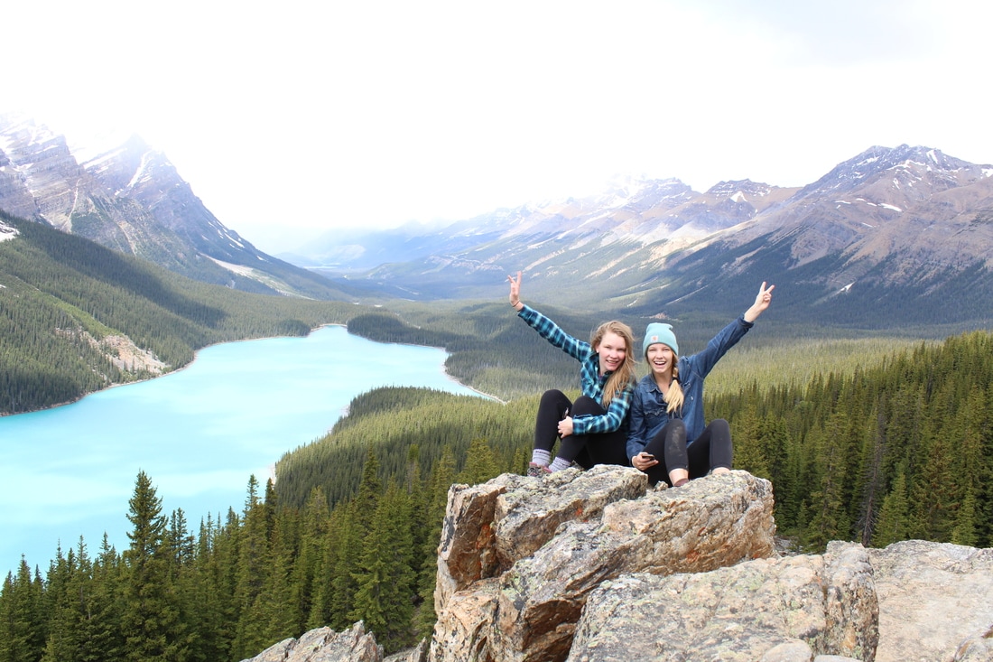
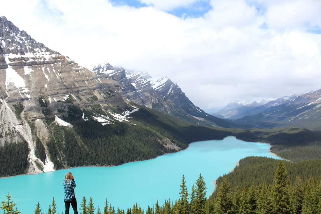
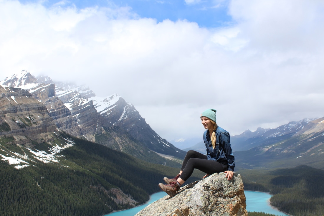
ELEVATION: Minimal DISTANCE: 0.7km Loop 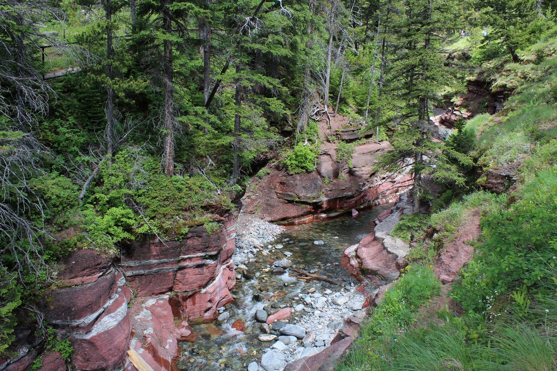 Turn off Hwy 5 and follow the Red Rock Parkway approximately 14 km’s until you reach the end of the road. Make your way along the well-marked paths that circuit the canyon. The complete loop is only 0.7 km. You will get awesome views of the fantastic red rock and the surrounding mountain range. This is a popular area so you can expect some crowds. If you want to explore further, head to Blakiston Falls.  Waterton is one of my favorite parks in Alberta. This is the first time I have visited in the summer and while it was busier that I had anticipated, it was probably the most beautiful time I have ever visited. The wildflowers were in full bloom, the water a perfect shade of blue and we got lucky with tons of sunshine and little wind. Waterton is a great place to bring the family as it has lots to see and it's very easy to get arounf. Some great places to visit are: - Red Rock Canyon & Blakiston Falls - Cameron Falls - Prince of Wales Hotel (the lobby is beautiful and the views of Upper Waterton Lake are great) - Downtown Waterton has lots of shops, unique places to eat, and a great ice cream shoppe. - Follow the lake shore around the town of Waterton. - Cameron Lake - Bears Hump I am looking forward to many more visits to Waterton. I can’t wait to try out some of the longer hikes in the area. If only it was a little closer to Calgary… I would probably visit every weekend. (p.s. these photos were taken at the Price of Wales Hotel) DISTANCE: 15 km drive from Waterton Village (one way) 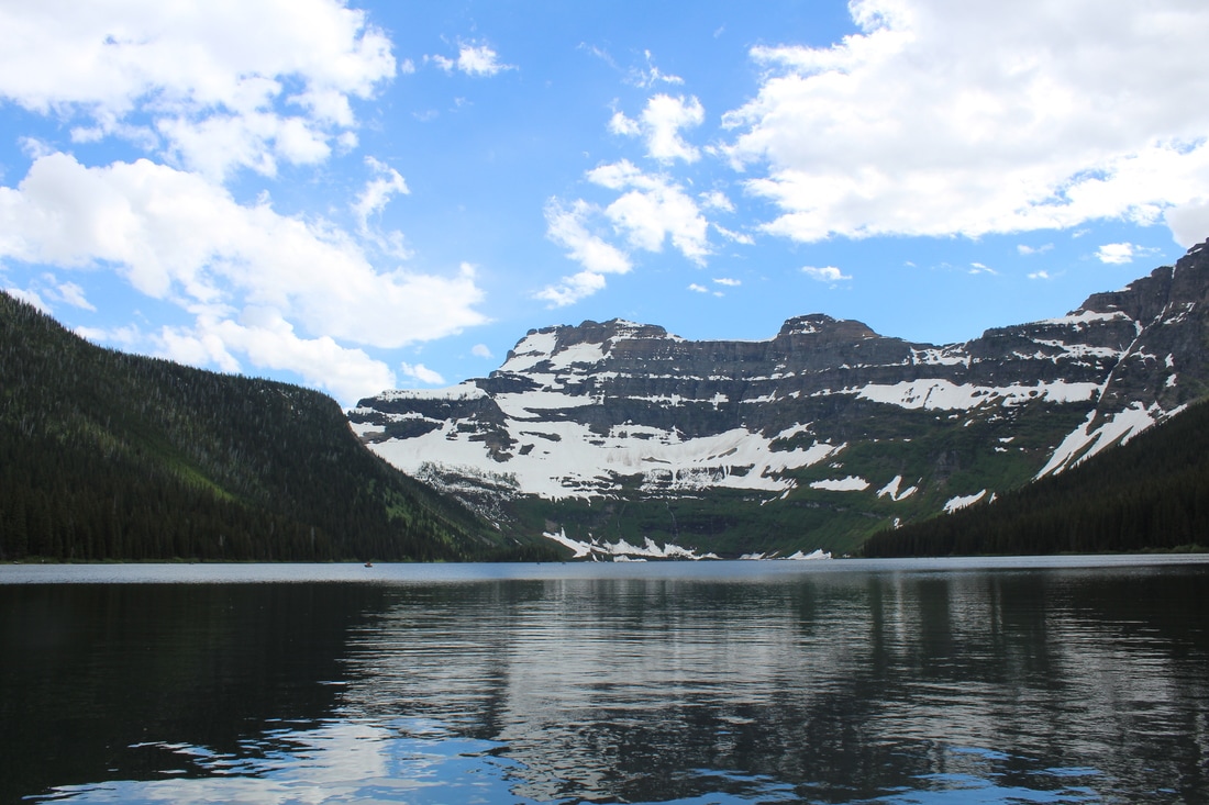 You can reach Cameron Lake by taking a 19 km trail from Cameron Falls, or you can drive 15 km’s up the Akamina Parkway to its shores. We opted for the drive since we were only visiting for the day. Follow the twisting narrow road (with plenty of pit stops) until you reach the lake. There is a trail that skirts around the left side of the lake following the shoreline (about 3km). This lake is very popular for canoeing and kayaking. The far end of the lake is in the US. Expect crowds on warm summer days. While Waterton is lovely, it can also be quite busy in summer months! 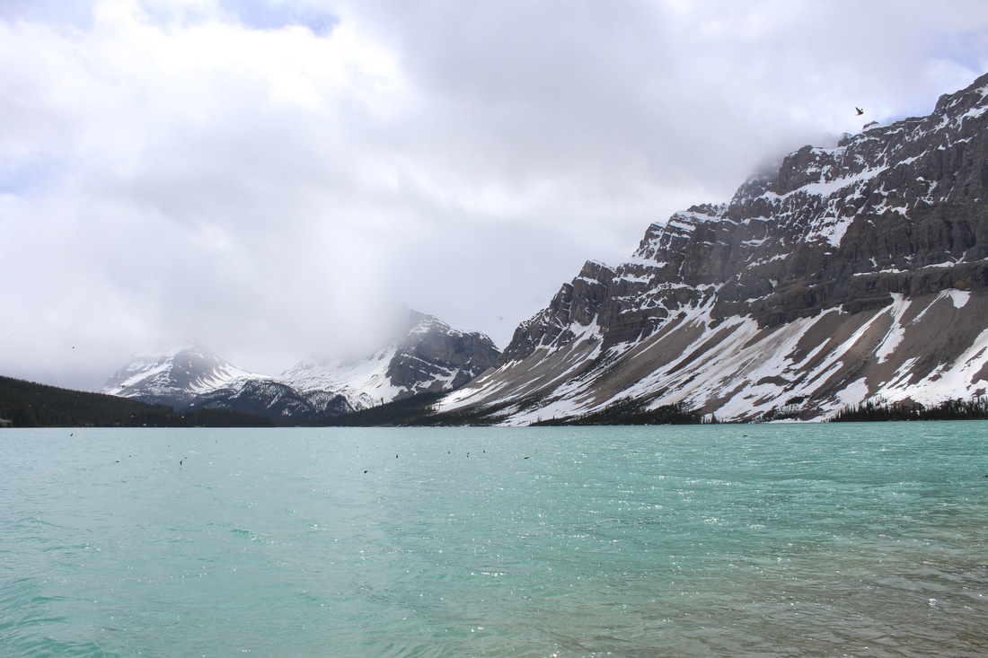 If you are travelling through the parkway this is an awesome place to take a pit stop. The views of Bow Lake are incredible, with its beautiful turquoise waters. Walk along the shore and take in the views of Crowfoot Mountain and the Bow Glacier. For those looking to go further, there is a trail you can follow to the Bow Glacier and Waterfall (3-4 hour hike). 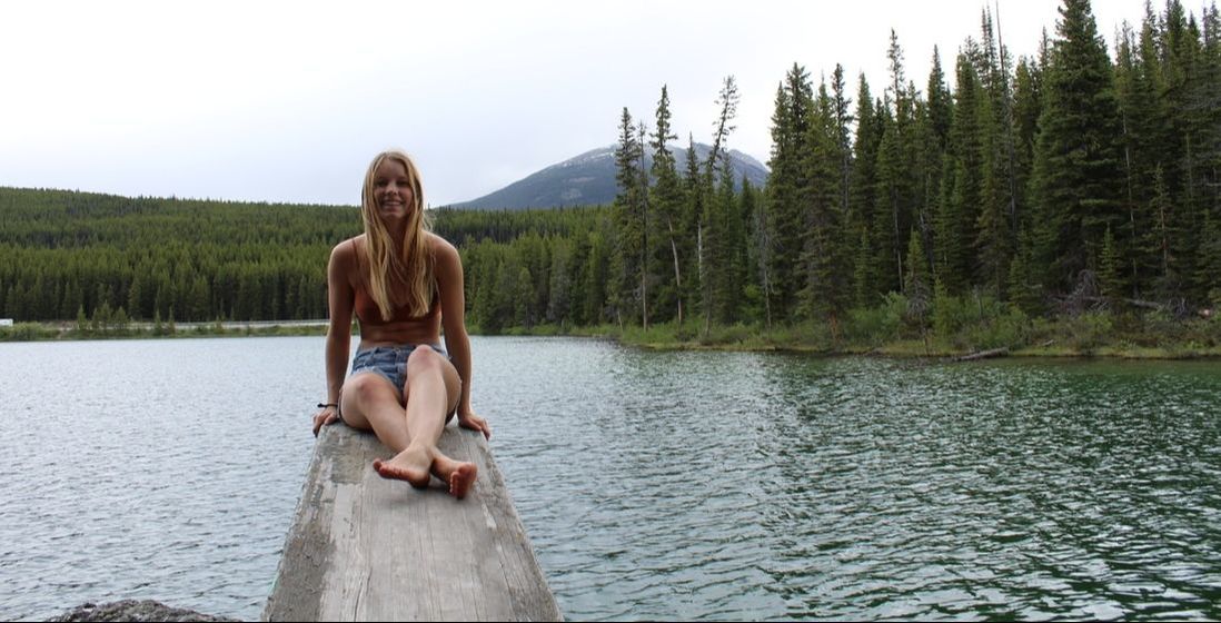 Looking to take a dip in a cold mountain lake? Look no further. Herbert Lake is a little oasis of mountain beauty. Just off Hwy. 93, approximately 7km north of Lake Louise you will find a day use area for this spot. It’s a great place to stretch your legs, and if it’s a warm sunny day, the perfect spot for a swim. You can follow a trail around the circuit of the lake. On the far SW corner of the lake you will come across a diving board and rope swing. The water is clear, deep and cold! Emi was brave enough to take the plunge on the rainy morning we were visiting. If you head clockwise around the lake you will need to walk on the shoulder of the hwy. until you see a trail skirt off into the trees. The counter clockwise route is a little longer, but is very scenic and you will get great views of the lake. I would suggest doing the complete circuit. I have heard there can be leaches in the lake but we didn’t see any. ELEVATION: Minimal DISTANCE: 1 KM Round Trip 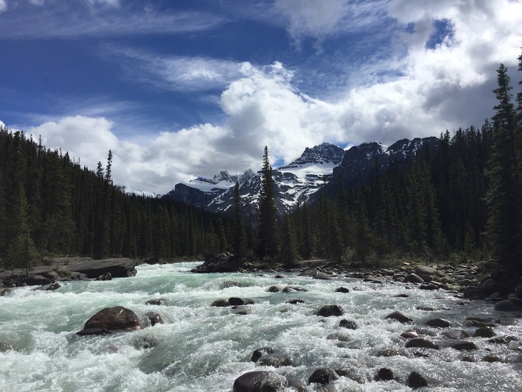 A perfect roadside pit stop! There will be a sign on the Hwy. indicating the parking lot for Mistaya Canyon. On the south end of the parking lot the trail takes you 300meters to a bridge overlooking the canyon. Take in amazing views of the steep canyon and raging water below. If you continue on the trail, you will find some dirt trails leading the river. Be cautious as there are no rails on this portion of the hike. We found a large rock overlooking the entrance of the canyon and enjoyed views of the surrounding mountains. The walk back to the car has some slight uphill so keep that in mind. 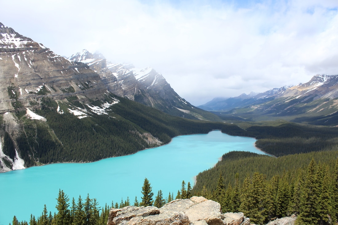 Peyto Lake is a classic stop on the parkway. Hundreds of people file up to the viewpoint on any given day. It’s a short hike, following a paved path to the main viewing area. If you want to escape the crowds here is a tip. Follow the trail to the main viewing area and continue on the paved path that goes to the left of the platform (Don’t take the trail to the bus parking lot). Shortly after, you will come across a sign showing a small loop that can be hikes. Go right at the fork and take the first dirt trail you see. This trail leads to an amazing viewpoint of the lake which we shared with one other couple (compared to the swarm of people on the viewing platform). The extra 15 minutes of walking is 100% worth it! Head back the way you came. |